Friday, July 14, 2017
Friday, July 7, 2017
Bishop to Mammoth
Made it to Mammoth! That means seven high passes and more stream crossings than I can count. It was also the longest food carry so the packs are only going to get lighter. Yay! I feel extremely lucky to be hiking through the high Sierra during such a snowy and spectacularly beautiful year. There are very few people on this section of trail which makes it all the more special. Shout out and thank you to everyone who has helped me get here.
 |
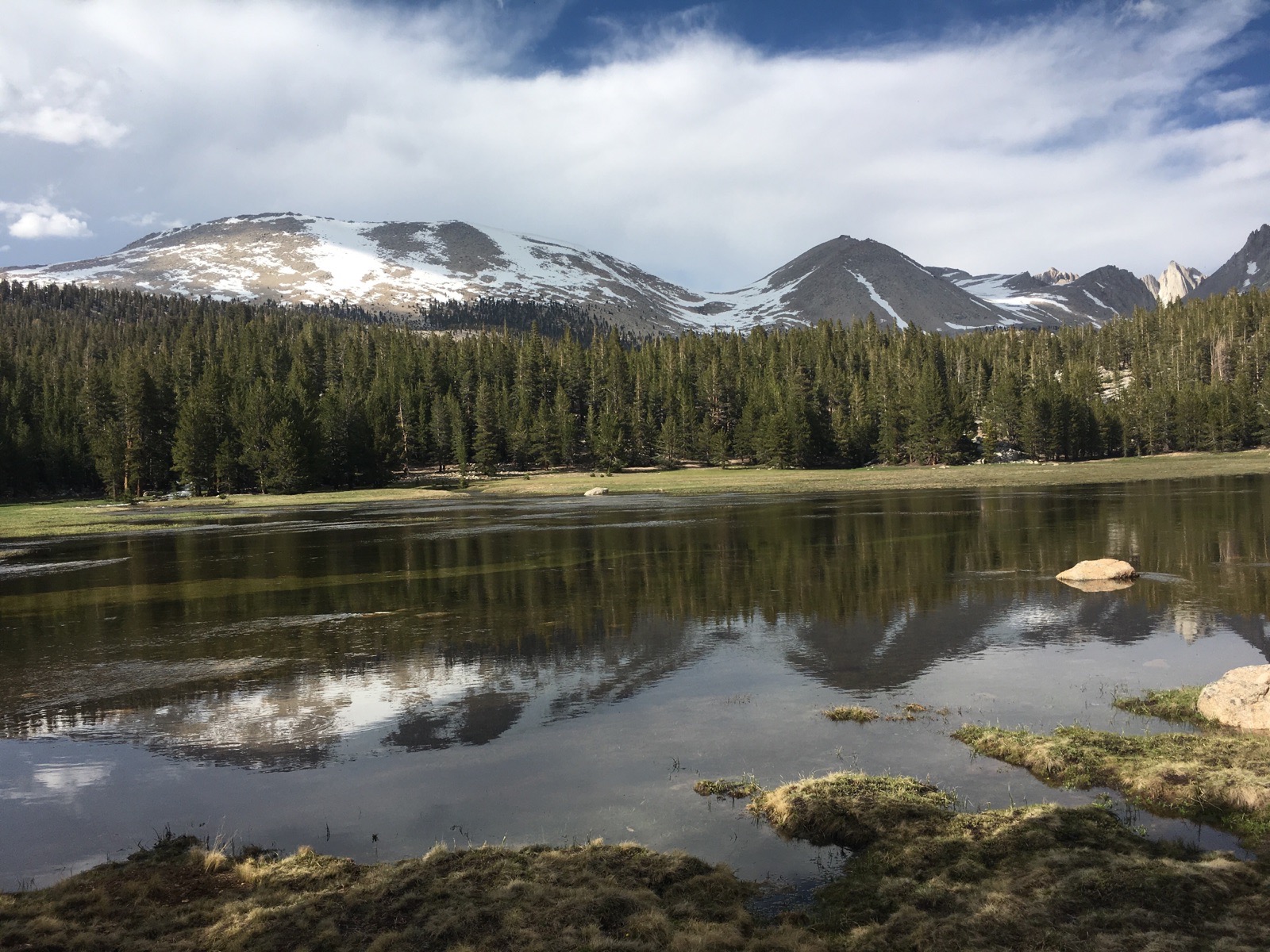
| Snack break by the lake on the way over Kersarge Pass |
 |
| Sometimes the snow is slick and we fall on our faces |
 |
| Morning light makes everything better! |
 |
| My cozy campsite between a rock and a tree in our tiny island of snow free camping |
 |
| Awesome granite cliffs above our campsite at sunset |
 |
| Standing on top of Pinchot Pass |
 |
| Fin Dome -looks like a fun place to climb! |
 |
| Every once in a while we find a bridge to cross the raging rivers... |
 |
| But most of the time we walk right through them |
 |
| Lots of evidence of large avalanches this winter! |
 |
| Climbing up Mather Pass, one of the more exposed and technical passes we had to cross |
 |
| Almost to the top! |
 |
| Self arresting after a fast glissade |
 |
| Palisade lake early in the morning |
 |
| Look closely to see four of our group standing on switch backs on the way down the golden staircase... the last piece of trail to be completed due to the steep and rocky terrain! |
so much power in these creeks!
 |
| Sun cups for MILES! These are extremely difficult to walk over and require a lot of patience and a lot of singing to get through |
 |
| The view from Muir Pass |
 |
| The team in front of the hut built on top of Muir Pass in 1936... we got there in time for a 5 am breakfast out of the wind :) |
 |
| Dinner party with Lisa, Lee and Willi, three inspiring people we met outside the laundry mat and decided to invite us over for spaghetti! |
Thursday, June 29, 2017
Mount Whitney, Foreseter Pass, and more
I am now traveling with a great team of seven hikers:
-Ungerwear
-Bamboo
-Olaf
-Mooch
-Lady
-Kareoke
-and Wasabi (me!)
We have made it 90 miles into the Sierra and has been both a challenging and rewarding experience. The mountains are stunningly beautiful and the rivers are icy cold. We climbed to the highest point in the contiguous U.S. (Mt. Whitney, 14,505') and crossed the highest pass on the PCT (Forester (13,200'). We are currently in Bishop researching the next section and replenishing our bodies with food. We will head to the trail early tomorrow morning with the goal of making it to Mammoth in the next 10 days. Packs are heavier with extra snow gear and calories but the beauty of the high Sierra is worth it. Enjoy the pictures.
 |
| Finished these massive burritos and then immediately put away a pint of icecream each. Hungry??! |
 |
| An afternoon thunderstorm rolled in around noon and hurried us down from Forester Pass. |
 |
| Forester Pass is the highest point on the official PCT at 13,200'. |
 |
| Tenacious flowers above 13,000' inspire me to keep climbing. |
 |
| Creek crossings are always more pleasant when we find a log! This one we had to camp on one side and wait for the water to drop overnight before we could cross safely. |
 |
| Traversing across steep snowy slopes to get down to our resupply in Bishop. |
 |
| Just a quick dip in an icy cold alpine lake. |
 |
| A warm campfire is just the ticket after two long days summiting Mt. Whitney and crossing Forester Pass. |
 |
| Not a bad view. |
 |
| Crossing the ice chute on Forester Pass, the highest point on the PCT. |
 |
| Sitting on the summit of Mt. Whitney, the highest point in the contiguous U.S. (14,505') |
 |
| Group photo on top of Mt. Whitney |
 |
| Sunrise as we hike toward the summit of Whitney. We left camp at 3:30am and got to the top by 7:45! |
 |
| Several miles of sun cups on snow fields during the approach to Mount Whitney. Glad we hit them while the snow was still firm! |
 |
| Chicken Spring Lake! A delightful place for a swim on a warm afternoon. |
 |
| Campsite right next to the lake. I often sleep out under the stars but the mosquitoes have been bad enough that my tent has been necessary every night. |
 |
| 700 miles means we are almost done with the desert! Time for some more water! |
Wednesday, June 21, 2017
 |
| Happy feet at a rest break! Hannah and I make a point to pull our shoes off and do a quick massage for each foot every few hours to keep them feeling fresh and blister free |
 |
| Walking through dappled sunshine in an oak grove we are happy for the shade |
 |
| 600 miles and technically entering the tail of the Sierra Nevada... the Tehachapi mountains |
 |
| An old sluice from back in the gold mining days, California is rich with mining artifacts from the late 1800s |
 |
| This is an example of the many gates ingeniously designed to keep dirt bikes and four wheelers off the trail while still allowing hikers and equestrians to easily pass through |
 |
| Beautiful desert vistas in the late afternoon light |
 |
| My favorite Joshua tree in bloom |
 |
| Sunset from camp |
 |
| First view of the mount Whitney group in the snowy Sierra! |
 |
| My favorite flannel bush, blooming brilliantly as ever |
 |
| Sunset heading into Walker Pass, the light that evening was spectacular! |
 |
| Lupine frequently adorns the trail as we hike |
 |
| The view from our campsite near the Spanish Needles, finally starting to feel like the rocky Sierra! |
 |
| A nocturnal cricket friend hopping around near my head |
 |
| Trying to hitch into Welden to do a quick resupply... ended up getting a ride in a Dodge Charger! Thank you, Dereck |
 |
| Spent the afternoon at a KOA swimming pool in Welden before hiking out 12 miles. What is better to rehydrate than watermelon! |
 |
| Found another Wenatchee friend on trail... Brooke Hagopian or Waves |
Subscribe to:
Posts (Atom)